Filo diretto con i geologi italiani    
 
Non sei ancora iscritto ?
Compleanni di Oggi
Alpe DrillProject (49), Fyorpa (44)
Chi è Online Ora
0 membri (), 547 ospiti, e 2 robot.
Chiave: Admin, Mod Globale, Mod
Top Poster(30 Giorni)
mccoy 3
antrea 1
Sponsor
GeoFoto
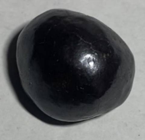
Frammento azzurro trovato in strada
by Keccogrin, December 6
Qualcuno sa di cosa si tratta?
by Alex_Bach, September 21
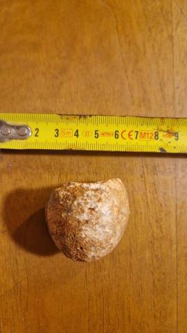
Uovo ?
Uovo ?
by ACM80, August 25
Riconoscimento roccia
by rama12, April 17
Sponsor
Sponsor
Discussione Precedente
Discussione Successiva
Stampa Discussione
Valuta Discussione
Iscritto: Jul 2002
Posts: 26
S
Junior Member
OP Offline
Junior Member
S
Iscritto: Jul 2002
Posts: 26
Sto cercando un software per il calcolo delle zone di protezione dei pozzi: qualcuno può darmi un suggerimento?

Iscritto: Oct 2000
Posts: 3,950
M
Member
***
Offline
Member
***
M
Iscritto: Oct 2000
Posts: 3,950
Isomap+Inquimap della Geo&soft di TO, sono studiati in questo senso


"Prosunt omnia quae obstant"
http://trossero.blogspot.it/
Iscritto: Jul 2002
Posts: 26
S
Junior Member
OP Offline
Junior Member
S
Iscritto: Jul 2002
Posts: 26
Grazie per l'indicazione della Geo Soft. Qualcuno è a conoscenza di software freeware per il calcolo delle fasce di rispetto dei pozzi?
Grazie
Silvano

Iscritto: Oct 2000
Posts: 3,950
M
Member
***
Offline
Member
***
M
Iscritto: Oct 2000
Posts: 3,950
Il sito dell'EPA statunitense è probabilmente la fonte di questi programmi ma non ci giurerei che siano gratis.

Se però devi fare un lavoro una tantum il programma della geo&soft lo puoi usare gratis per 15 giorni, quindi.


"Prosunt omnia quae obstant"
http://trossero.blogspot.it/
Iscritto: Jul 2001
Posts: 80
L
Member
Offline
Member
L
Iscritto: Jul 2001
Posts: 80
ciao,
puoi scaricare il freeware WHAEM 2000 dal sito dell'epa (www.epa.gov), 6,5 MB ma ne vale la pena e totalmente freeware; solo devi ravanare dentro al sito per trovarlo perchè i link sono impossibili, come cercare la caccia al tesoro.
Fammi sapere

lorenz

Iscritto: Oct 2000
Posts: 3,950
M
Member
***
Offline
Member
***
M
Iscritto: Oct 2000
Posts: 3,950
WHAEM 2000
WhAEM 2000 is a public domain, ground-water flow model designed to facilitate capture zone delineation and protection area mapping in support of the State's Wellhead Protection Programs (WHPP) and Source Water Assessment Planning (SWAP) for public water supplies in the United States. Program operation and modeling practice is covered in a series of progressively more complex representations of the wellfield tapping a glacial outwash aquifer for the city of Vincennes, Indiana. WhAEM2000 provides an interactive computer environment for design of protection areas based on radius methods, well in uniform flow solutions, and geohydrologic modeling methods. Protection areas are designed and overlaid upon US Geological Survey Digital Line Graph (DLG) or other electronic base maps. Base maps for a project can be selected from a graphical index map for the State. Geohydrologic modeling for steady pumping wells, including the influence of hydrological boundaries, such as rivers, recharge, and no-flow contacts, is accomplished using the analytic element method.

Known Deficiencies

Unhandled Error will occur when adding binary base maps (BBMs) to a new project under Windows95, when the project is created in the c:\Program Files\WhAEM path. The work around is to create all new projects under a different path, say c:\WhAEM.DAT\.
There is an incompatibility of the Tool convert DLG to BBM for some USGS maps. We are working to fix this.
SYSTEM REQUIREMENTS

Intel 80486 DX/66 or higher microprocessor system (Intel Pentium highly recommended)
Windows 95 or 98, or Windows NT 4.0 operating system
25 MB free disk space
16 MB memory (32 MB or more gives MUCH improved performance)
VGA display or better (SVGA in resolutions with 800x600 or higher resolution give best results)
Mouse or other pointing devise
Windows compatible printer (optional)

WhAEM 2000 for Windows

WhAEM 2000 is a ground-water flow model designed to facilitate capture zone delineation and protection area mapping in support of the State's Wellhead Protection Programs (WHPP) and Source Water Assessment Planning (SWAP) for public water supplies in the United States.

WhAEM 2000 is public domain software and may be freely downloaded at http://www.epa.gov/ada/csmos/models/whaemwin.html


"Prosunt omnia quae obstant"
http://trossero.blogspot.it/

Moderated by  Greenhouse, Valerio_gpk 

Link Copiato negli Appunti
Ultimi Post
Armadio Portacarte Regma
by servizigeo - 20/08/2026 09:54
Vendo sistema inclinometrico completo - SISGEO
by nuvola rossa - 14/08/2026 15:44
Manifesto vintage scala ere fossilifere
by Silvia70 - 12/08/2026 08:53
RocLab della Rocscience
by mccoy - 11/08/2026 03:44
STRUMENTAZIONE PER SISMICA SARA
by antrea - 06/08/2026 08:30
Statistiche del Forum
Forum34
Discussioni21,085
Post147,885
Membri18,160
Massimo Online17,513
Jul 9th, 2026
Nuovi Membri
jacolix, Silvia70, Mercorelli A., domenico craparo, GeoFra92
18,160 Utenti Registrati
Sponsor
www.geologi.it bar-2
bar-3

Per domande o commenti su questo sito Web info@geologi.it

Powered by UBB.threads™ PHP Forum Software 7.7.5
(Release build 20201027)
Responsive Width:

PHP: 7.4.33 Page Time: 0.011s Queries: 26 (0.004s) Memory: 2.9511 MB (Peak: 3.2551 MB) Data Comp: Off Server Time: 2026-08-24 19:28:03 UTC
Valid HTML 5 and Valid CSS